Brisbane Metro Bike Track
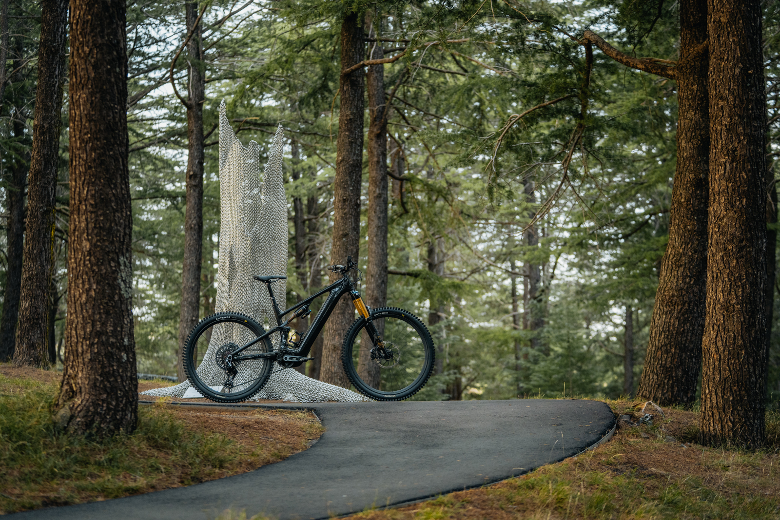
Mountainbiking Brisbanites are lucky when it comes to trails.
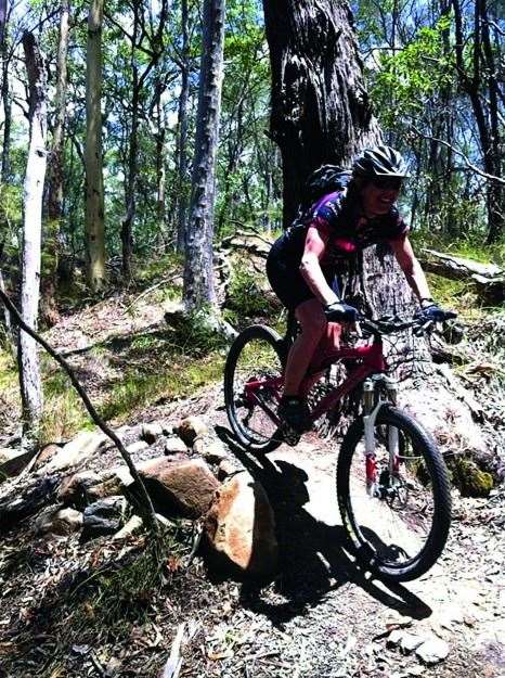
Mountainbiking Brisbanites are lucky when it comes to trails. If you ever visit a Brisbane mountainbiker in their natural habitat, you may well be lucky enough to get a peek at some of the amazing trail networks we have on our doorstep. Unlike major cities such as Melbourne and Sydney, just a few kilometres from the Brisbane city lay gravel, trees, rocks and singletrack delights.
Need to Know
Toilets Yes, in the first section between Jinker Track and Collins Road
Drinking Water Yes, in the first section between Jinker Track and Collins Road and on Jinker Track
Parking Yes
Trails Signposted Yes
Mobile Reception Yes
Shelter Yes, in the first section between Jinker Track and Collins Road
BBQ Facilities Yes, in the first section between Jinker Track and Collins Road
Accomodation Brisbane city and surrounds
While in the area Head to nearby Samford village for a coffee and post-ride treat, only a few kilometres up Samford Road from the bottom Ironbark parking
Local Bike Shops Strathpine Bicycle Centre, north of the trails in Lawnton, 3205 2447. MyBikeShop, Mitchelton, 3355 0112
Local Club Contacts North Brisbane MTB Club (Dirt Dogs MTB), executive@dirtdogsmtb.org
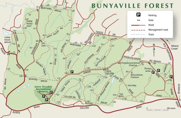
Bunyaville and Ironbark
Getting There
‘Bunya’ trails are approximately 12km north of the city, and can be split into three sections: the first lies between Collins Road and Jinker Track (off Old North Road) and is the closest part to access from the CBD; the second part is between the Jinker Track and Bunya/ Dugandan Road; and the third lies over Dugandan Road. Parking is available at James Drysdale Recreation reserve or along Jinker Track, in the midst of the trail network.
Just a short bitumen traverse from Bunya trails (along Bunya Road to Linkwood Road and to the end) brings you to top of the compact Ironbark Trails. Ironbark is also accessible from Samford Road. The bottom trailhead is approximately 2km past the Ferny Grove train station.
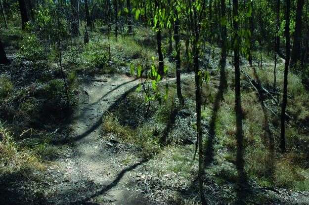
Technical Nature
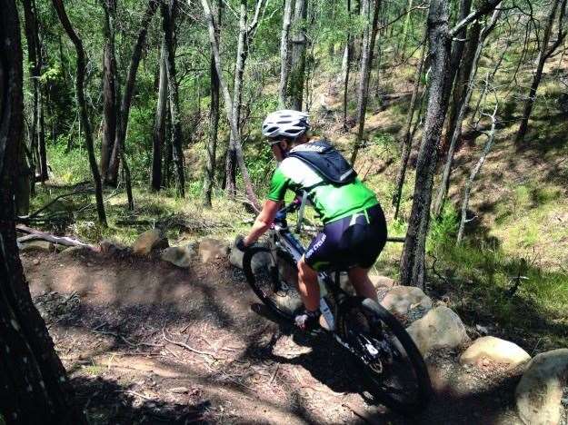
Typical Australian bush and a gritty rocky surface makes Bunya and Ironbark a little different to other trail networks in South East Queensland. While not excessively technical, the sketchy trail surface and many built trail features will keep you on your toes whether you are a beginner or advanced rider.
You’ll Need
An XC or trailbike, the usual spares, food and riding gear are a few necessities. Pack for the amount of time you expect to spend out there.
Distances
The whole of Bunya can be covered in around a 25km loop, encompassing fire-roads and singletrack. Travelling to and from Ironbark adds 5km, and from there you can add another 12km of predominately fire-road with sections of singletrack.
Local Knowledge
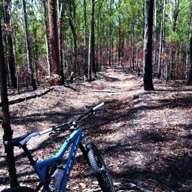
The trails periodically undergo ‘controlled burns’, which is advertised at major trailheads along Jinker Track in the weeks prior. Riding after the controlled burn allows a seldom seen view of the trails snaking around the landscape unobscured by bush.
Best Time of Year
Anytime! Though riding in the peak of day in summer is a steamy affair. Bunyaville and Ironbark hold up quite well in the wet.

Gap Creek Trail Network
Getting There
The main trailhead is off Gap Creek Road, Kenmore Hills, and has picnic, water and toilet facilities, as well as a recently developed skills park area. When driving, you can access Gap Creek Road via The Gap or Kenmore. Gap Trails can be accessed on the bike via the Mt Coot-tha Road climb (Sir Samuel Griffith Drive), with the three- sisters fire-road opposite Channel 9, pinging you down to the top of Dingo Trail.
Technical Nature
With a wide range of trail options, from the easy, green ‘Rocket Frog’ to the black diamond (but very achievable on a hardtail) ‘Pipeline’, Gap Creek is a melting pot for cyclists of all abilities.
You’ll Need
An XC or trailbike, spares, food and riding gear are the few necessities.
Distances
To do all the trails including those on the northern side of Gap Creek Road, you will be looking at around 24km of riding, with a good deal of elevation gain.
Local Knowledge
Gap Creek trails are well built, but they don’t drain as well as the Bunya/Ironbark network, so avoiding the singletrack in the wet is recommended. However, after a good drop the soil packs down to the closest thing that Brisbane has to hero dirt.
Need to Know
Toilets Yes
Drinking Water Yes
Parking Yes
Trails Signposted Yes
Mobile Reception Yes, but can be patchy
Shelter Yes
BBQ Facilities Yes
Accomodation Brisbane city and surrounds
While in the area If riding over Mt Cooth-tha, head back through Paddington for a cornucopia of coffee-shop options.
Local Bike Shops Epic Cycles, Paddington, 3368 2324. Crank House Cyclery, Bardon, 3161 8964. Ashgrove Cycles, Ashgrove, 3366 0379. Kenmore Cycles, Kenmore, 3378 0288. Taylor Cycles, Chapel Hill, 3878 7874
Local Club Contacts Kenmore Cycling Club, kenmorecycleclub@gmail.com, D’Aguilar Range Cycling Club, mtbdrcc.wordpress.com/
Events Gap Creek trail network hosts many Brisbane shops’ bike demo days. Ask the local stores when their next one is on and you could demo the latest bikes on great trails.
Best Time of Year
It gets pretty frosty (by Brisbane standards) in the valley of the main trailhead in winter, and likewise it’s hot and steamy, but definitely not sexy, riding in the peak heat of summer. Riding through winter days, autumn and spring is optimal.
Daisy Hill and Cornubia
Getting There
Heading south from Brisbane CBD along the Pacific Motorway, take Exit 19, Rochedale Road, and follow the road towards Springwood. Follow Springwood Road to the end, and turn left onto Daisy Hill Road.
Follow this to the end which lands you at the parking in the Upper Day Use area. Alternatively, take the Underwood Road exit, following Underwood Road to where the sporting fields, dog park and BMX track is. The trails can be accessed opposite the BMX track.
Cornubia trails are accessed from Kimberley Drive, Shailer Park, only a short ride from the Nirvana end of Daisy Hill.
Technical Nature
Trail favourites such as Stonehenge and Nirvana are enough to keep a more advanced rider on their toes when ridden with a bit of grunt. However, Daisy Hill has often been described as a great place to introduce newbies to riding, due to it’s relatively flat profile and straightforward trail features.
Cornubia trails, though close to Daisy, are more technical and challenging, featuring steeper, rougher trails and more technical trail features.
You’ll Need
Bikes, spares and food are a few essentials.
Need to Know
Toilets Yes, Daisy Hill trailhead
Drinking Water Yes
Parking Yes
Trails Signposted Yes
Mobile Reception Yes
Shelter Yes
BBQ Facilities Yes
Accomodation Brisbane city and surrounds
While in the area The Rochedale Deli near the IGA on Underwood Road does a mean milkshake and breakfast.
Local Bike Shops 99 Bikes, Underwood, 3341 7444. Hyperdome Cyclemania, Shailer Park, 07 3801 1484
Local Club Contacts Brisbane South Mountain Bike Club, www.bsmc.asn.au
Events The nearby Underwood Park is host to short course XC races in the summer months. Check the Brisbane South Mountain Bike Club website www.bsmc.asn.au for more details
Distances
To do a total Daisy loop is around sixteen to eighteen kilometres of singletrack, and Cornubia has another 13km of trails.
Local Knowledge
Daisy Hill has a labyrinth of trails, which are once again very popular on the weekends and through peak use times.
Best Time of Year
Daisy Hill is not the place to head in the wet, as its trail surface and lack of elevation turns the northern part of the trails into a slop-like chocolate swamp, but less tasty.