The 5 best apps for mountain bikers
We all ride with a phone, so why not make sure it's doing some work for you while you carry it?
We all ride with a phone for safety, so why not make the most of this tiny computer and optimise our cycling training? Here I discuss my 5 favourite must have apps for any mountain biker, and how they can improve your fitness.
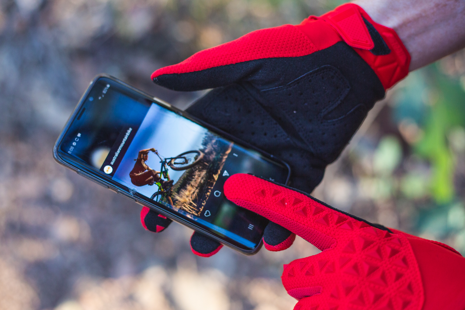
Strava
In a nutshell: Social media for endurance athletes
Price: Free, extra features available via premium subscription ($14.99/month, $99.99/year)
Strava is kind of like the OG cycling app for cyclists and endurance athletes: while you can track a range of sports from kayaking, alpine skiing to golfing, Strava’s core features are centred around cycling, running and swimming.
Strava allows you to connect with your mates and see their on-bike adventures (doling out ‘kudos’ on their rides), and you can also upload photos alongside your rides. Strava allows you to follow your favourite mountain bikers and road cyclists and marvel at their insane rides, power output, and length of the epic climbs they have in Europe. For those of you not using a training-specific app (Such as intervals.icu or Training Peaks) Strava offers many useful features to track your training load and performance in one place.
Key features for training: Your profile offers many ways to visually quantify your training load over the last week, month and year and enables you to click through the map image of each ride to access more information. You can also head to the Calendar page which features a monthly view with a bar graph representing completed volume of rides, which you can expand upon to view each within a monthly calendar view. Premium users can create their own routes to plan big adventures.
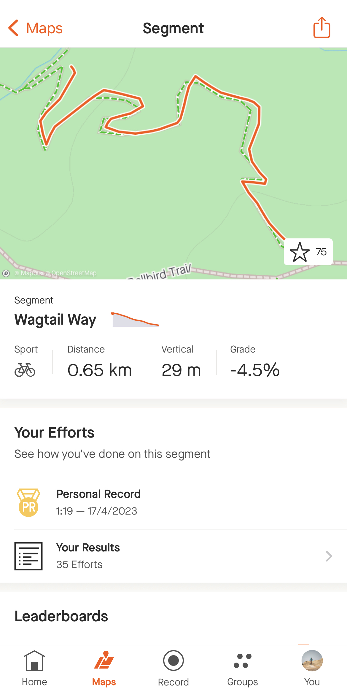
Strava’s most popular features is Segments, which allows anyone to pick a start and end point on any terrain, marking it as a segment. Then everyone who completes the segment receives a notification allowing them to compare how they are ranked when they upload their ride.
Controversial opinion: I don’t actually use segments unless intentionally looking to develop or test something, wantonly chasing ‘segment’ cups and crowns (when you’re the fastest you’re the KOM or ‘king of the mountain’) is a recipe for fatigue, but they can be useful when used intentionally. If you pick a few segments and add them as ‘my segment’, it will flag this with your completed time each time you have ridden it. This is a little reminder that you can then click through and see all historical performances on that segment (Premium feature). It’s been incredibly useful for myself and athletes when looking to develop a particular physiological attribute (ie: high torque, high intensity climbs for example, or repeatability within single segment repetitions), and check progress intermittently with single or multiple all-out efforts.
Ride with GPS
In a nutshell: Mapping cool adventures and sending them to your cycling computer.
Price: Free (allows mapping and uploads!), extra features via premium ($9.99/month, $79.99 year) Premium allows turn by turn navigation within the app, access to RidewithGPS heatmaps, offline maps, live tracking.
RidewithGPS is one of the many mapping and tracking apps that’s available, but it’s always been my go-to option. This app really speaks to my soul and allows me to inject adventure and curiosity into what could otherwise be pretty boring 5hr rides.
The free version is quite comprehensive: you can create routes then download them for turn-by-turn navigation with your third party device, upload your rides, and create goals (ie: metres climbed, kilometres ridden). While there is a free version, most of the features of premium are based on using the app itself for offline or turn-by-turn navigation, with the exception of their heatmaps.
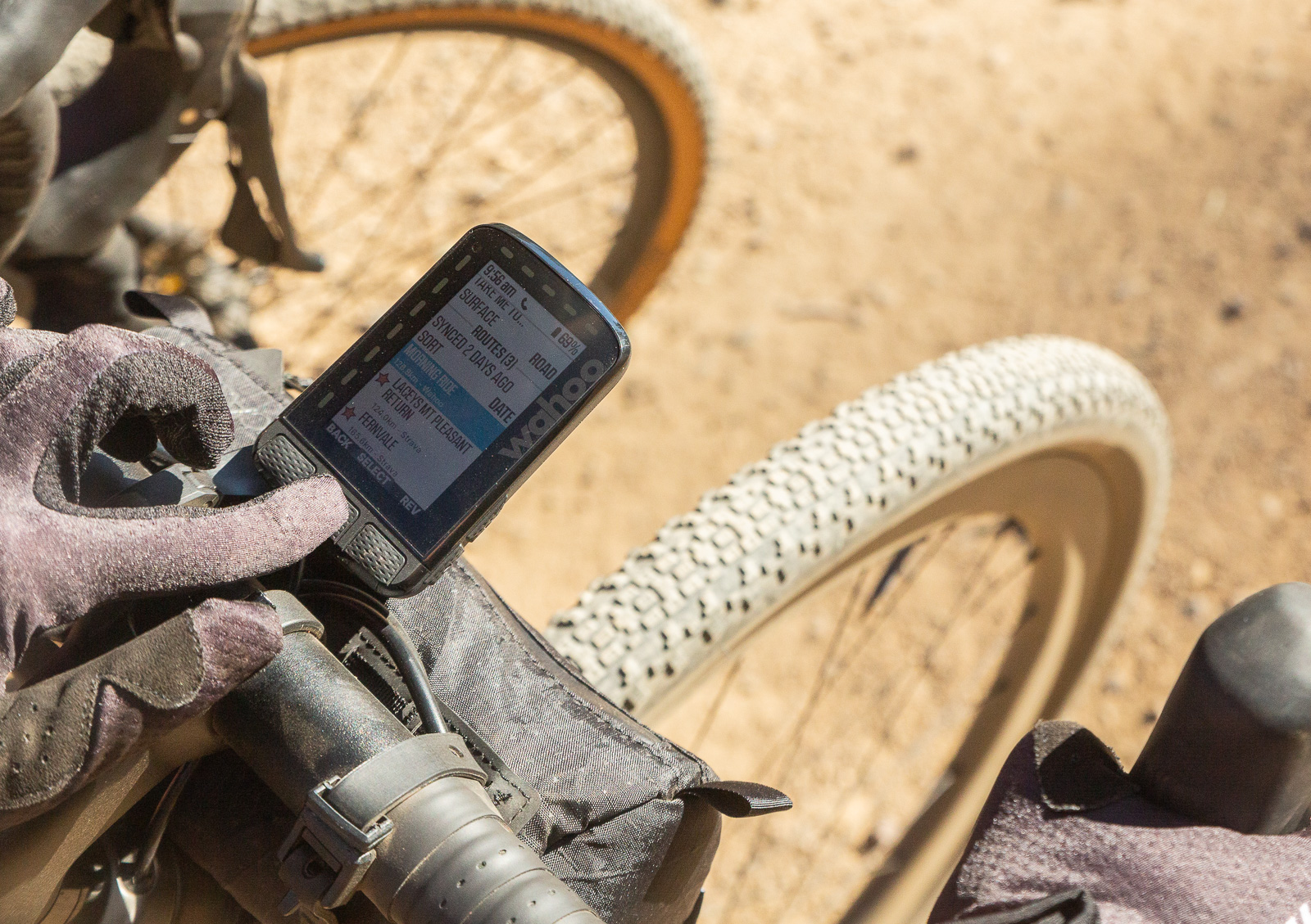
Key features for training: Plan a big old adventure! RidewithGPS’s click to draw feature makes it easy to put your start location in, then click on the map down roads and gravel and trails to create your adventure. There are a range of map views available (I like ‘Terrain’ as it offers some basic topography alongside street maps), and the profile will build under the map as you click away, with the profile representing dirt vs road surfaces as well! When you’re done, you can save and share the file, and download to your Wahoo/Garmin/whatever for turn by turn navigation.
One caveat: sometimes roads and trails exist on maps that do not exist in real life. This is where the premium option and heatmaps can come in handy. Hot tip: you can use RidewithGPS alongside Strava’s FREE heatmaps (with far more collated user data), and creating routes is infinitely better on the desktop than the phone app.
Garmin Connect
In a nutshell: Training and a myriad of physiology-based tracking in one place.
Price: Free, but you need a Garmin device (sorry!)
This may be a strange one to put in as a favourite app as it requires a Garmin device—even moreso when you know I use a Wahoo and Hammerhead cycling computer—but bear with me. Garmin have created what I think is the current pinnacle of the endurance sport ecosystem with their Connect app, and even though I use it with my Garmin Fenix watch (usually tracking hikes, runs but only occasionally rides) it is still extremely useful.
Key features for training: For those using a Garmin cycling computer or watch to track training, the in-app analysis allows several charts with heart rate, power and elevation overlays as well as graphical representation of your data, which is similar to many other apps. The beauty of the Garmin Connect app, though, is the supporting data you attain via consistently tracking your rides, or wearing your fitness watch. While you can look at a number of apps to track your sleep, stress, heart rate variability and steps, the Garmin ecosystems brings them all into one place. For female athletes, it also features menstrual cycle and pregnancy tracking. If you’re looking at downloading a bunch of different apps for these functions but it all seems too hard, most of these features work with Garmin’s basic fitness watches.
One caveat is to take Garmin’s suggested recovery times with a grain of salt: if we all listened to their recovery time recommendation we would never actually get out to ride. Take it more as an indication of the load of each day.
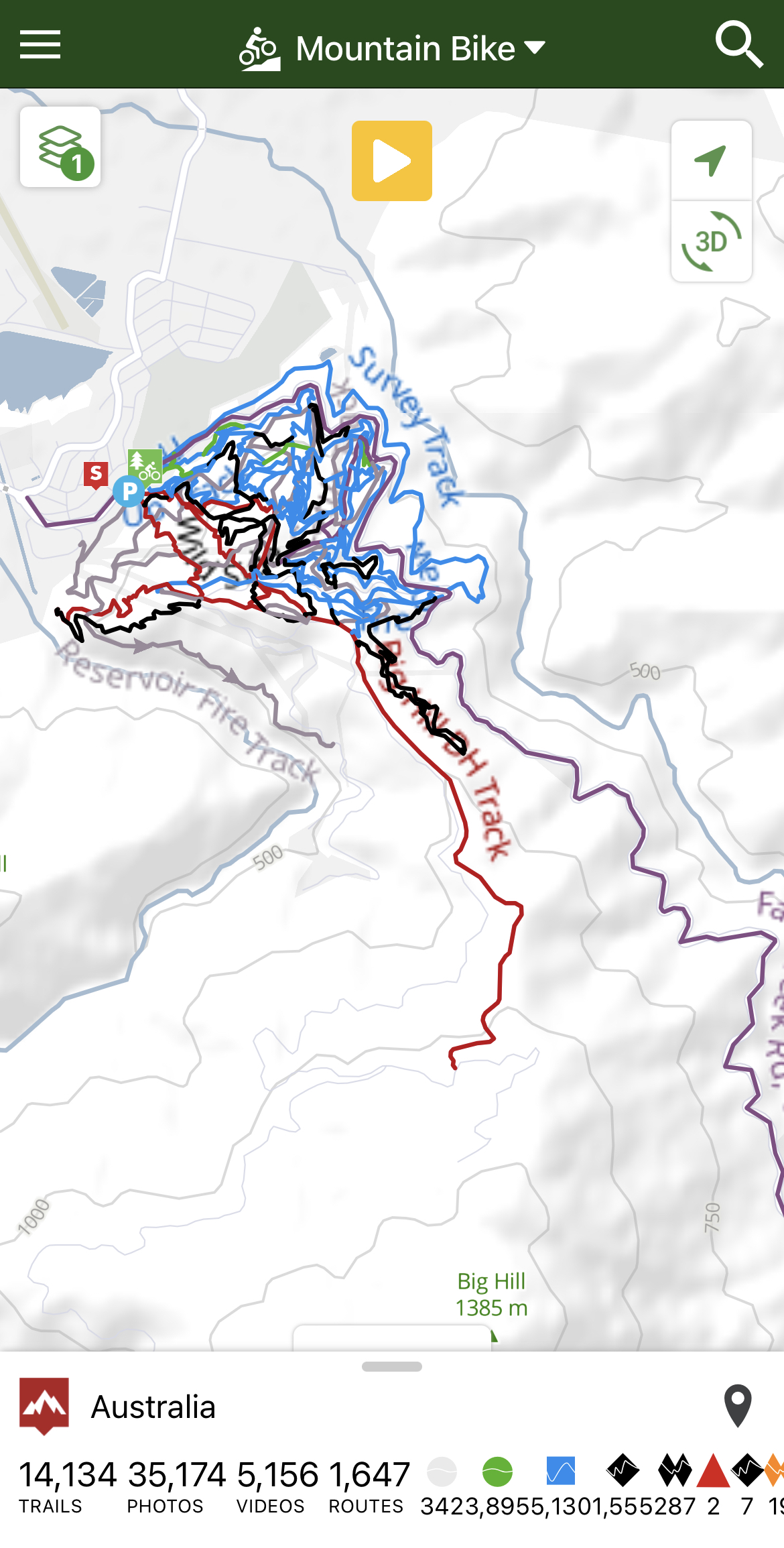
TrailForks
In a nutshell: Trail condition reports, reviews and exploring new mountain bike trails.
Price: Free (desktop), $35.99/year for Premium, allowing downloads of trail and route GPX files. Access to global heatmaps.
While the free option is limited on the app (you can see all trails via desktop though!) think of Trailforks as the mountain bike equivalent of a surf cam or wave guide. Trails can be updated by users, giving condition reports and starred ratings, making this the must-have app for any mountain bike related travel. While I am not all about purchasing premium versions of apps, I would fork out the $$ for this one to be able to safely export new trail networks.
EmergencyPlus
In a nutshell: If you break your leg, you want these people to know where you are.
Price: Free
Developed by emergency services, the EmergencyPlus app uses your phone's GPS to generate coordinates as well as ‘what three word’ technology to precisely find your location with 000 call takers. This is an app you hope you never have to use, but having been on the user side of the equation, as well as on the other side (wandering through a forest looking for an injured patient who has no idea where they are and is giving inaccurate location information) I can tell you that this app can and does save lives. Just download it, you never know if you will need it!