Mountain biking in Adelaide
Images: Kane Naaraat and Ian Fehler
Images: Kane Naaraat and Ian Fehler
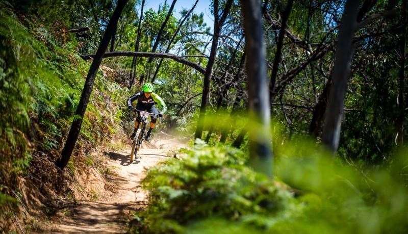
It’s been a bit of a local secret for years that Adelaide has some of the best terrain for mountain biking close to any state capital city in Australia. But they have been hard to find, and most visitors ended up being disappointed with having to settle for a short spin in the steep race venue of Eagle mountain bike park, the only location close to town that was publicly promoted as a trail centre.
It was something of a surprise then, when in January 2015 the SA government announced an ambitious pledge to turn the whole Adelaide Mount Lofty Ranges region into an international mountain bike destination with an initial budget of $1.5m to get the wheels rolling over 3 years, and with more funding to be negotiated. There are plans for new trails, improved trailheads, information and infrastructure, and plans to encourage involvement with tourism providers and the community to promote and develop the trail network.
Encouraging mountain biking in the Adelaide Hills would seem a no-brainer. Part of the massive appeal to riding in the Adelaide Hills is the fact that many of the trails start about 7km ride from the city centre. There is also a train line that climbs from the CBD up to Blackwood in under 30 mins, with access direct to existing trails in Sturt Gorge, Belair, Mitcham and Lynton and Shepherds Hill, and bikes are welcome.
There has already been a massive amount of new trails built in the Southern Hills and also at Cudlee Creek (through separate funding), and this plan hopes to build on this momentum. The final report has only now been released with major plans and recommendations. Plans include up to 3 ‘hero’ descending trails in the hills. Two of these are likely to involve flow trail routes in the vicinity of the existing Yurrebilla and the Pioneer Women’s trails, both of which are currently popular climbing and descending trails for local riders, but not strictly legal for riding. The third trail is earmarked to be a 8-12km flow trail from the existing trail network of Cudlee Creek back to the city, and there are also plans for an epic XC touring trail linking across the entire hill face.
Although most of the recent development has been mostly focused on trails in the Southern Lofty Ranges, there are plans for new trails and development in the Northern areas too in the near future.
Currently the South Australian Department for Environment, Water and Natural Resources (DEWNR – the managers of the State’s National Parks) are overseeing the project, but with plans for an independent multi-partner authority to manage the network and project, and with further funding to be found in the following years. Most certainly the future is bright for mountain biking in the Adelaide region.
The Southern Lofty Ranges- Belair, Sturt Gorge, Shepherds Hill and Lynton.
The recent explosion of new trails and the consolidation of previous existing trails in the areas around Blackwood has given Adelaide riders a massive new expanse of terrain to explore. The network of trails would total over 100km across all areas, and covers sections of Mitcham council land, as well as various recreation parks and national parks managed by DEWNR. Whilst Mitcham council have been slowly chipping away at consolidating their trails and building some new trails over the last few years, it is the massive investment in new trails in the DEWNR parks of Shepherds Hill and Sturt Gorge, and the linking of these trails with Mitcham trails that has almost overnight created an urban MTB mecca in the hills. And all in an area just 10km from the city, an easy 30 minute train ride.
Once you know your way around the area, it is very easy to link up the various trails and parks. However if you are new to the area it’s probably at first easiest to explore one park in detail, then work out how to link them together.
Shepherds Hill Recreation Park is probably the easiest of the parks to reach, with the main carpark being on Ayliffes Road, St Marys, just off South Road. DEWNR has been working with three local trail-building companies Trailscapes, Trail Solutions Australia, and Environmental and Trail Services to turn what was a relatively underused public space with a scattering of rough user built trails into something really special. The park has a new pump and jump ‘bowl’ and a kids’ zone near the main car park. There are some easy beginner trails, and 3 really fun interweaving intermediate downhill trails – they are short, but very easy to ride back up to the top. The use of natural rock features through the olive grove encourages rider progression too, and the views over the Adelaide plains to the ocean is stunning. Trails also link from here back to Mitcham Council’s Lynton trails, or up towards Eden Hills train station, where you can then ride a short distance onto the Craigburn Farm/Sturt Gorge trails.
The Mitcham Council managed trails in Lynton have been open for 5 years now, and provide some excellent links and routes between the Belair/Blackwood region and the Adelaide Suburbs, and have some excellent trails to climb up or descend back down, and link into Shepherds Hill. There are also some pretty tricky DH trails from Windy point, and the trails are now well mapped and sign-posted. A good place to enter these trails (if you like a climb) is at the Lynton Depot, adjacent to the Lynton train station.
Another ideal starting point is to explore the trails of Sturt Gorge Recreation Park. The Craigburn Farm section has become a popular favourite with locals in the last 5 years, with a nice mix of 18km of singletrack, arranged in loops that allow for a short ride or a much harder longer loop.
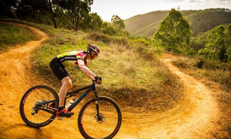
However it is probably the new additional trails in Sturt Gorge itself that have made the biggest impact on the area, and the circumnavigation of the Gorge is set to become a classic. The total ride is about 23km in length, almost entirely off-road, mostly on singletrack, and with about 10km of brand-new bench cut trails built lovingly by local trail builder Garry Patterson’s company Trailscapes. These flowing trails weave through olive groves and offering stunning views of the ocean and city in the distance. The only problem is it’s hard to want to stop and enjoy the view when the trails just scream out to be ridden fast! The De Rose decent in particular is guaranteed to put a smile on your dial!
The Sturt Gorge loop is easiest to follow starting from Craigburn Farm. Head off past the lake and down to Horner’s Corner bridge. Turn left across the bridge and immediately you will pick up the Wattle Trail, which follows the Sturt River for a few kilometres along beautiful singletrack with the occasional rocky section, some which may require a little bike carrying!
The Wattle Trail leaves the river and climbs steeply to then skirt through native bush for a few kilometres, before you get onto the newer purpose-built sections of the Lomandra and De Rose trails. Once you hit the bottom of the gorge, cross the river and head up the second half of the De Rose trail up more beautiful bench-cut trails with the odd rocky section thrown in, and a few tight switchbacks. At the top, after taking in more views of the gorge and the ocean, turn left and follow the Tapa Turrungka trail (‘The path on the ridge’ in the local Kaurna language). This trail skirts the top of the northern side of the park, and has been a popular trail with riders for years, and has a natural feel. At the end of this trail, drop a few hundred meters down along Mountbatten Road, which drops you into a short section of Mitcham Council land. There are a few ways to navigate the short climb back up to the Craigburn Farm trails, with all trails recently mapped and sign-posted. Of course you can ride it in the opposite direction too!
Nearby Belair National Park also is open to mountain bikers, and whilst most of the trails are firetrails, there is also a signposted 12km ‘Adventure Loop’ which has some super-fun and tricky singletrack sections, and adds an extra easily navigable option to extend rides in the trails at Sturt Gorge and Craigburn too.
- GETTING THERE
The most obvious start points are from Lynton train station near Mitcham, Shepherds Hill Recreation Park trailhead off Ayliffes Rd, St Marys, or the Craigburn Farm trailhead, adjacent to the Blackwood Football Oval, in Sturt Gorge Recreation Park.
- BEST RIDES
For a short beginners loop or some excellent intermediate DH trails, hit Shepherds Hill.
For the keen XC rider the Sturt Gorge circumnavigation is a classic 23km adventure.
- LOCAL KNOWLEDGE
Have a look on Google maps of the area, it is possible to link all these areas together easily with a short link through surrounding suburbs to create 100km or more epics!
- WHEN TO GO
Trails are open year-round, although some parks are closed in extreme fire danger or days of Total Fire Bans. Spring and Autumn are the best times for perfect riding weather.
- WHILE IN THE AREA
Joan’ s pantry in Hawthorndene does an awesome coffee and some lovely cakes, wraps and hot food, and is half way between Belair and Craigburn on the river bike track, making it a perfect lunch stop. www.joanspantry.com.au
Local Shop: The best local MTB shop is Bicycle Centre Mitcham at 21 Belair Road, Kingswood SA 5062, near the start of the Mitcham/Lynton trails.
Bike Hire/Guiding: Escapegoat Adventures are based at Eden Hills, right in the middle of the area and a 2min walk from the Eden Hills train station. They offer hardtail and Dual suspension bikes for hire, as well as guiding and skills training.
More maps and details:
For maps and information on DEWNR parks and trails, visit the parks website environment.sa.gov.au/parks/Visiting/Cycling.
adelaidemtbtrails.com has the most up-to-date maps and info on the general area.
Fox Creek/Cudlee Creek trail network.
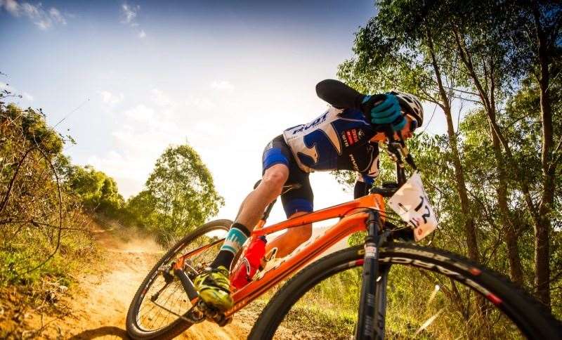
Fox creek (also known as Cudlee Creek depending on who you talk to) is the grand-daddy of mountain bike trails in the Adelaide region, and is a firm favourite with local riders of all persuasions. It’s always had a bit of everything, with shuttle-able Downhill trails and a nice mix of XC trails, but most recently there has been a massive flurry of new trails that have been built which has more than doubled the riding options in the forest.
Traditionally there were two ‘zones’ of the forest, with the XC trails up the top, and 5 downhill trails dropping down steeply to Fox Creek Road. More recently though the new trails have blurred the boundary, and opened up a load more options to the new type of trails the new breed of mountain bikes demand.
The biggest recent developments have been thanks to Local club ‘The Human Projectiles’ who have done an amazing job in securing funding to develop a number of new trails, and build those trails, all overseen by local MTB legend and ex-IMBA Australia National Director Nick Bowman. BikeSA and ForestrySA have also assisted with funding on various projects. There are also a keen group of volunteers who maintain the trails regularly.
The Croft Road triangle car park is the most popular start for anyone not shuttling the DH trails. From here you can head into the pines for some old school tight XC trails. Alternatively you can head off into the native bush on the intermediate Outcrops trail, or the brand new green ‘Easy rider’ trail. It’s well worth the ride out to along the ridge past the Thomas Hill centre to the lookout following the Cudlee Creek Cruise trail for some stunning views down to Port Adelaide.
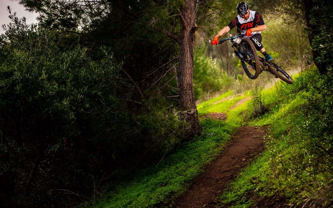
For those that like a bit of an adventure, the trek out to the new trails in the north of the area really give you a sense of isolation. ‘Dirty Little Secrets’ and ‘Ant Logic’ are both wickedly fun intermediate ‘flow’ trails that bomb down into a previously unvisited valley. Just be warned, until a new volunteer-built climb is finished (sometime next year), the only way back to the top is via a nasty climb back up on fireroad! But it’s worth it.
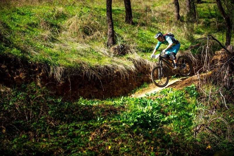
Probably the most popular new trail though, and suitable for all, is the CORE loop, incorporating 2 trails, the climb up ‘Middle Earth’, and the descent down ‘Green Smoothie’. ‘Middle Earth’ is a gradual singletrack climb through stunning native bush, with the occasional steep pinch thrown in to work the legs, climbing the 200m or so over roughly 4km. ‘Green Smoothie’ on the other hand is a riotous flow trail which is suitable for all, but just cries out to be ridden fast. It’s an awesome introduction to the fun of blasting downhill dropping all the way back down to the bottom over 3km, and is easily shuttle-able too.
For DH, most people use the lower car park on Fox Creek Road as a base to run shuttles. The five DH trails are very popular, and a new intermediate DH trail has recently been built to offer some progression from the easy Green Smoothie, up to the more technical black DH trails.
And just to top it off, Fox Creek now even has a winery serving wood-fired pizzas, beer, and (of course) wine next to the car park- what else could you want?
- GETTING THERE
Fox Creek/Cudlee Creek: take the Hahndorf turnoff from the Freeway then follow the Onkaparinga Valley road through Verdun and Balhannah towards Woodside and Lobethal. When you enter Woodside turn left onto Tiers Road and follow this until you come to Lenswood. Cross the Lobethal Road, and head up Coldstore road for a few km’s. At the top of a hill you will come to the Forest, and the Croft Road junction. For the top XC car park (and top of the DH trails) turn left along Croft Road for 1km. For the bottom DH car park continue 2km down Fox Creek road, and you will find the car park on the left.
- BEST RIDE
Don’t miss at least one run on Green Smoothie. Dirty little Secret is also really worth exploring, as long as you have something left in the legs for the climb back out.
- LOCAL KNOWLEDGE
If you are planning a long ride, it’s often worth starting the ride at the bottom DH car park, and climbing up the Middle Earth climb first. After exploring the best of the trails up the top you can then finish your ride with a downhill blast down Green Smoothie or one of the DH trails as a final reward.
- WHILE IN THE AREA
Why not try a little beer or wine tasting? The extremely MTB friendly ‘Anderson Hill’ winery is opposite the top car park, and is open on the weekends offering wine tasting and wood fired pizzas.
If beer is more your thing, the nearby Lobethal Bierhaus microbrewry on the main street of Lobethal offers awesome beers and food too.
Local Shop/Bike Hire:
-
Bikeabout have bike shop at Woodside (just 3km away), and also offers bike hire and guiding.
-
Escapegoat Adventures also offer guiding (with bike hire) to Fox Creek and other local , including transport from the city
Best sites for information:
For the best and most up-to-date map of the Cudlee Creek forest, visit adelaidemtbtrails.com
A GPS based map can be downloaded and used on your mobile. Just go to humanprojectile.com/foxcreek/ and enable GPS on your mobile for live tracking on the map.