The great east coast mountain bike road trip
Images: Robert Conroy and others
Images: Robert Conroy and others
The great easterly route
The roads between Melbourne and the Sunshine Coast collectively form the most driven route in Australia. At just shy of 2,000km, even by Australian standards, it’s a very, very long drive. Fortunately, it’s a route that offers plenty of places to break up the monotony of the motorways with a spin around some of Australia’s best mountain bike trails. If you’re pointing north through winter (or anytime), make sure you find the ones that suit your trip.
Yarra Trails
The first potential stop on the trip to Queensland begins well within Melbourne’s limits. The Yarra Trails follow the course of the Yarra River as it snakes its way north-east from the city centre. The trails connect with the multi-use paths that in fact begin at Southbank, in the heart of Melbourne. If it’s dirt you’re after most advise joining the trails at Fairfield Park Boathouse off Heidelberg Road.
The trails are a mixture of short sections of singletrack which branch off the main trail often with steep drops to the river below. There is some designated singletrack at the northernmost point of the trail, approximately 25km north east of the CBD.
The network of trails provides around 50km of riding for a return trip – remarkable considering how close it sits to one of the most densely populated areas in Australia. And best of all, being Melbourne, you’re never far from a decent cup of coffee before the next leg of the drive!
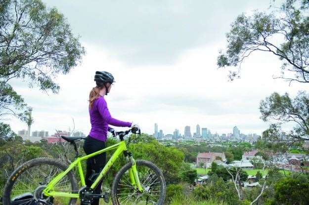 Photo: Mandy Lamont
How to get there
Proximity to surrounding suburbs provides plenty of access. If entering from the south most recommend entry at Fairfield Park Boathouse via Heidelberg Road, Fairfield.
Alternatively, the trail’s northernmost point, Westerfolds Park in Templestowe, provides parking. Take the second exit off Fitzsimmons Land, Templestowe.
Website: yarracity.vic.gov.au
LBS: Countless! Just do a location search from where you are.
Distance from main road: > 1km
Beechworth
Follow the Hume Highway two hours north and you’ll start to see signs to Beechworth. When the exit arrives, take it. Beechworth’s Mountain Bike Park has quickly built a reputation as one of Australia’s top spots for cross-country mountain biking and plays host to the incredibly popular Six Hours in the Saddle event in August.
Originally constructed by local Scott Fitzgerald and his team, the trails available provide everything for beginners to advanced riders. The park’s XC track takes in around 8km of trails, which range from flowing singletrack to tighter, technical sections.
The trails provide hours of fun and Beechworth itself, located five minutes from the Mountain Bike Park, has plenty of fine food, wine and beer enjoy afterwards. In fact missing the brewery and pizza shop would be hard to forgive.
How to get there
Beechworth Mountain Bike Park is located on Alma Road, Beechworth. Follow the Hume Highway (M31) from Melbourne and take one of the many, well-signposted turn-offs to Beechworth.
The most direct route is along Beechworth-Wangaratta Road (C314) via the exit at East Wangaratta. Once in Beechworth turn right on to Camp Street and left onto High Street. Alma Road will arrive on the left after approximately 1.2km.
There’s parking available, just be sure to bring water with you or pick some up in town.
Club contact: info@beechworthchaingang.com
Website: beechworth.com
LBS: Beechworth Cycles & Saws, 17 Camp Street, Beechworth, Victoria, 3747
Distance from main road: Approximately 40km east of the Hume Highway.
Albury/Nail Can Hill
The final stop in Victoria and the first New South Wales are located just across the Murray River from one another. Wodonga, on the Victorian side, is home to Hunchback Hill Mountain Bike Park. Development of the trails is ongoing, but a combination of well-built singletrack and rock garden sections is a fun way to finish off in Victoria.
On the north side of the Murray River is the Nail Can recreational trails. Weaving their way through the Nail Can Reserve, they form a network of trails, many of which are used in local XC races. The trails range from intermediate trails to a pair of trails for more advanced riders (Point Rock and 50-50).
Albury-Wodonga is the main entrance between Australia’s two most populated states, so there’s plenty of options when it comes to food and accommodation.
How to get there
Located just 40 minutes north of Beechworth, Albury-Wodonga is on the Hume Highway (if you’re coming from Beechworth returning to Beechworth-Wangaratta Road (C314) will shave a few minutes off the journey).
Hunchback Hill Mountain Bike Park is located at the western end of Felltimber Creek Rd, Wodonga. The best way to access Nail Can Hill is to park at the end of Range Rd (off Logan Rd), Albury.
Club contact: info@alburywodongamtb.org.au
Website: alburywodongamtb.org.au
LBS: Cycle Station Albury, 480 Young St, Albury, NSW 2640
Distance from main road: The trailhead for Nail Can Hill is approximately 2km from the Hume Highway.
Tumut
Tumut may be located on the outskirts of the Snowy Mountains, but it holds its own when it comes to facilities for mountain bikers. The area offers hundreds of kilometres of firetrails winding through both native and plantation forests which are dotted around the Tumut region.
The best developed for mountain biking is definitely Tumut State Forest, which contains a network of fireroad and singletrack. The trails are provided for both mountain bikers and walkers so be aware when riding, however with plenty of trails to explore there’s plenty of room for everyone.
Tumut itself is a wonderfully historical place to stay. Once central to the Snowy Mountains Hydro-electric scheme, it’s now more focused on timber and tourism, the latter providing ample eateries and pleasant accommodation.
How to get there
Follow the Hume Highway (M31) until you see the exit to Tumut. Follow the Snowy Mountains Highway (B72) for approximately 40km. Trailhead parking for Tumut State Forest is located next to Tumut Golf Club on Fairway Drive, Tumut.
Club contact: enquiry@mtbwagga.asn.au
Website: visittumut.com.au
LBS: None in Tumut, so make sure you’ve got spares. Wagga Wagga is located 70km west.
Distance from main road: Tumut is 30km east from the Hume Highway
Bundanoon/Wingello
Over the past decade Bundanoon and Wingello’s reputation as a go-to mountain bike location has grown exponentially.This reputation is helped in part by massive events such as the Highland Fling, but is assured through the wonderful towns and fantastic trails that abound in the surrounding Penrose and Wingello State Forests.
There’s around 200km worth of trails divided between the two forests, made up of firetrails, double track and singletrack sections. Wingello offers a larger trail network and a few more hills than Penrose. If you have an overnight stay planned, the trails are close enough to explore both.
Bundanoon and Wingello are sleepy towns, however the friendly hotels and restaurants have helped to rejuvenate many a weary rider so you’ll be hard pressed to find a more hospitable location.

How to get there
Wingello and Bundanoon are located along Penrose Road, off the Hume Highway. Exit the Hume Highway (M31) at Highland Way and follow Penrose Rd to Wingello. Bundanoon is located approximately 10km further down the road.
Wingello State Forest is accessed through Wingello. The trail head is accessed by passing village store on Railway parade, and turning left onto Forest road. Follow this for 4km until you reach the a clearing. Here you’ll find a map and toilets.
Access to Penrose State Forest is at the corner of Old Argyle Road & Ferndale Roads, Penrose.
Website: highlandstrails.com.au
LBS: Ye Olde Bike Shop, 11 Church Street, Bundanoon NSW 2578
Distance from main road: Wingello is located 10km from the Hume Highway.
Mt Annan
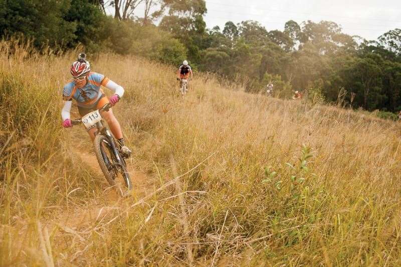
The trails circling the Australian Botanic Garden at Mount Annan have quickly become one of the favourite spots for Sydney riders hoping to escape the hustle and bustle of the city. Open during the Garden’s hours of operations (8am-5pm), there’s over 10km of trails to explore, divided into three loops designed for beginners, intermediate and advanced riders, respectively.
The trails can be closed during periods of heavy rain, so it’s best to check the Gardens’ Facebook page for its current status.
There’s plenty of facilities located within the park including toilets, drinks and food.
How to get there
The Australian Botanic Garden is located along Mount Annan Drive. Take the Mount Annan exit from the Hume Highway (M31).
Website: rbgsyd.nsw.gov.au/annan
LBS: ABC Bikes Campbelltown, Homebase, 6a/24 Blaxland Road, Campbelltown, NSW, 2560
Distance from main road: >1km from Hume Highway
Awaba State Forest
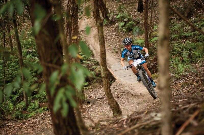
Having skirted around the relative chaos of Sydney, Awaba State Forest is located some 130km north on the Pacific Motorway just before Newcastle. Containing a well-marked 12km cross country loop and a 3km downhill track, it’s a mountain bike mecca that’s perfect for riding all year round – but not so good after rain. Made up of a range of firetrail and singletrack, there are options to suit riders from beginner to advanced.
There’s plenty of parking available, and the Awaba course plays home to the Hunter Mountain Bike Association, who maintain the trails, so there’s regular racing if you feel like spicing up your ride by pinning on a number.
How to get there
Exit the Pacific Motorway (M1) at Freemans Drive and turn right onto Mount Faulk Road. The trailhead is located at the corner of Mount Faulk Road and Jenkins Road, which is the first road on the right.
Club contact: presidenthmba@gmail.com
Website: hmba.asn.au
LBS: Breakaway Cycles, 65 Dora Street, Morisset, NSW, 2264
Distance from main road: The trailhead is about 5km from the F3 exit
Taree
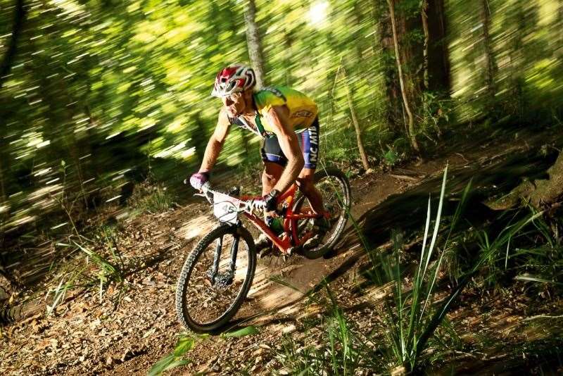
Well over half way from Melbourne to the Sunshine Coast now, the Pacific Highway will deliver you to the Kiwarrak State Forest, located a few kilometres from Taree.n Its name may be unfamiliar to some, but Kiwarrak contains over 40km of singletrack coursing through a forest that extends southwards from the Manning River.
The incredible length of the singletrack is linked by even more fireroads creating a huge network of trails. It’s a location that will certainly justify a few days in the area for proper exploration. There’s plenty of accommodation options nearby too. Taree is only a few kilometres north, and the relaxed beach-side towns offer camping and other places to stay.
How to get there
A car park built in 2014 marks the trailhead opposite the entrance to a refuse tip on The Bucketts Way, which comes off the Pacific Highway (A1) just a handful of kilometres before Taree. That’s why they are also known as the ‘Tip Trails’.
Club contact: bourkesbicycles@tsn.cc
Website: mgltipriders.asn.au
LBS: Bourke’s Bicycles, 1 Mill Close, Taree, NSW, 2430
Distance from main road: >1km from the Pacific Highway.
Port Macquarie
Port Macquarie has a deserved reputation for endurance sports, and mountain biking is no exception. Home to the Hastings Valley Mountain Bike Club, ‘Port’ as it’s affectionately known offers an abundance of trails.
The Region is circled by State Forests, many of which contain rideable trails, giving locals and visitors alike plenty of options. Best of all, it’s beach side location makes it a family friendly stopping point en route to the Sunshine Coast.
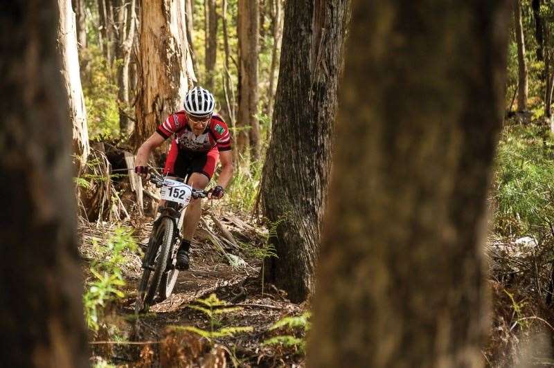
In addition to the fireroad and singletrack that snake their way through the State Forests, Port Macquarie even boasts an Urban Mountain Bike Park with a range of trails just south of the city centre. You might even see Jason English out training on the local trails.
How to get there
Port Macquarie is located 8km east from the Pacific Highway. Take the Port Macquarie exit and follow B46 into town. Refer to the Hastings Valley Mountain Bike Club for details on accessing trails in the surrounding State Forests. The Urban Mountain Bike Park can be accessed via Hockey Place.
Club contact: hvmbrclub@gmail.com
Website.hvmbr.com/
LBS: Gordon Street Cycles, Shop 3,163 Gordon Street, Port Macquarie, NSW, 2444
Distance from main road: Port Macquarie is located 8km from the Pacific Highway
Nambucca Heads
The Queensland border is creeping closer, but there’s still some beach-side mountain biking bliss in New South Wales to be had first at Nambucca Heads.
The Jacks Ridge Mountain Bike Track covers 10km of fast, flowing singletrack that winds through the Nambucca State Forest. It may only be 10km, but with a variety of uphill and fast downhill sections, huge logs, ramps and berms to enjoy, you’ll enjoy more than a few laps before considering calling it for the day.
When the call is made, head a few kilometres north to Nambucca Heads town centre. There’s everything from B&B’s to cabins and camping, many of which have a beach-side vantage. Taylors Arm Pub, immortalised by Slim Dusty’s ‘The Pub With No Beer’, is unlikely to experience a repeat of that particular war-time incident and is one of many bars, cafes and restaurants.
How to get there
Jacks Ridge Mountain Bike Track is accessed via a trailhead on Old Coast Road, which turns left off the Pacific Highway (A1) north of Nambucca Heads town centre.
Website: nambuccatourism.com.au/
LBS: CK Cycles & Skate, Shop 3, 14 Cooper St, Macksville, NSW, 2447
Distance from main road: Less than 3km from the Pacific Highway
Armidale
If you’re not a beach person you can swap the coast for a trip inland as there’s a glut of trails available to visitors in the New England area.
New England Mountain Bikers (NEMTB) do an incredible job advocating and maintaining many trails and tracks around Armidale. The most extensive of these is ‘The Piney’ amidst the pines of the Armidale State Forest. There’s a range of singletrack, faster trails and rock gardens that provide something for everyone. There’s even a skills park if you want to take the opportunity to tune up your technique.
Elsewhere, Robbers Run offers a short (2.3km) but occasionally steep (20%) run for those wanting to hone their downhill skills. Robbers Run can be connected up by bike with Fat Tyre Farm, where NEMTB members are working hard to expand a selection of curated singletrack.
Further afield, 70km west of Armidale, the Walcha Mountain Bike Trails offers a hilly 9km loop of trails.
It’s worth noting that Armidale sits at 1,000m above sea level so packing an extra layer is a good insurance policy against changeable conditions.
How to get there
The NEMTB website is a great resource for locating trail heads. To get to The Piney locals recommend riding the 5km along Rockvale Road from its intersection with Erskine Road. Alternatively, there is parking located close to the trails just before Heatherston Road.
Website: nemtb.com.au
LBS: Bicycle Central On Marsh, Shop 5/85 Marsh Street, Armidale NSW 2350
Distance from main road: Armidale is located 160km west of the Pacific Highway (A1)
Daisy Hill
Having made it across the New South Wales-Queensland border Daisy Hill offers a stop just before the final push to the Sunshine Coast. Set in the southern suburbs of Brisbane, the Daisy Hill Regional Park contains facilities for mountain bikers, walkers and horse riders
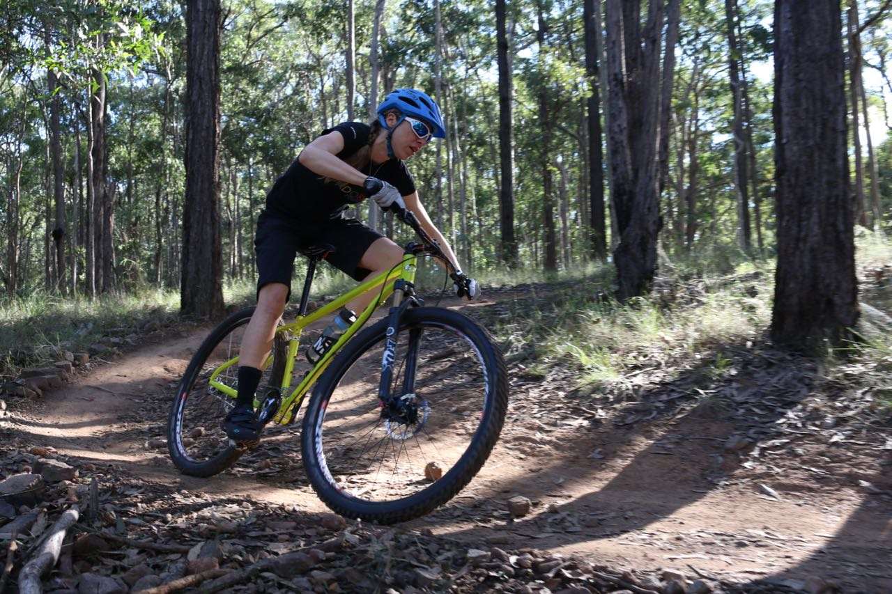
The area contains four relatively short MTB-only sections (500m – 1.4km), though when factoring the shared trails, Daisy Hill provides around plenty of kilometres of trails to explore. The 530m Tunnel of Love trail provides a short downhill run including a challenging rock garden near the top of the trail.
There’s no accommodation within the park but being located so close to Brisbane and the Gold Coast there’s plenty of options nearby. If you’d started your journey at the Yarra Trails, this is just another example of great mountain bike infrastructure fitting into an urban area. Gap Creek and Cornubia are even closer to town – but not so close to the mighty M1.
How to get there
Daisy Hill Regional Park is easily accessed from Brisbane or the Gold Coast via the Pacific Motorway (M1). From the Gold Coast, travel north along the Pacific Motorway and take exit 24. Follow the signs to Daisy Hill Road and the entrance to the park.
There are also a number of gates around the park boundary that can be accessed by mountain-bike riders.
Website: qldmtb.com.au
LBS: Rad Cyclery, 4/2 Grevillea St, Tanah Merah, QLD, 4128
Distance from main road: <5km from the Pacific Highway
Tewantin
Located just west of Noosa, there could be few better ways to celebrate your arrival on the Sunshine Coast than with a ride through the trails of Tewantin National Park.
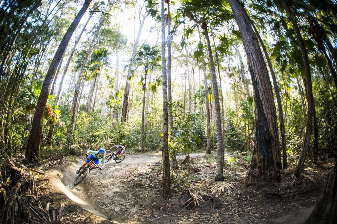
Beautiful singletrack laces its way through palm trees and gums as it charts an increasingly challenging course through half a dozen trails in the area. The Hovea and Glossy trails provide a gentle introduction, before Froglet and Keelback take you to the highest point in the park.
From the highpoint, the trails provide a combination of flowing descents with tight switchbacks and the occasional sharp ascent as the contour lines of the area close up. The builders are pretty active, so don’t be surprised to find some new trails when you visit.
After a days riding in the Queensland heat you’ll definitely have worked up an appetite. Fortunately, Tewantin and the Wooroi trails are just a 15min slow drive to Noosa.
There are many ways into Tewantin National Park. The best trailhead is found on Cooroy Noosa Road which dissects the park. Enter the trails at Wooroi Day Use Area, close to the junction of Beckmans Road and Cooroy Noosa Road.
 (c) Tim Bardsley-Smith
Website Noosa Trailblazers
LBS: Venture Cycles, 2 Venture Drive, Noosaville, QLD, 4566
Distance from main road: The trail head for Tewantin National Park is 10km east of the Pacific Highway.
